

A weather operations room is seen at the State Operations Center on January 31, 2023 in Austin, Texas. Photo: Brandon Bell/Getty Images
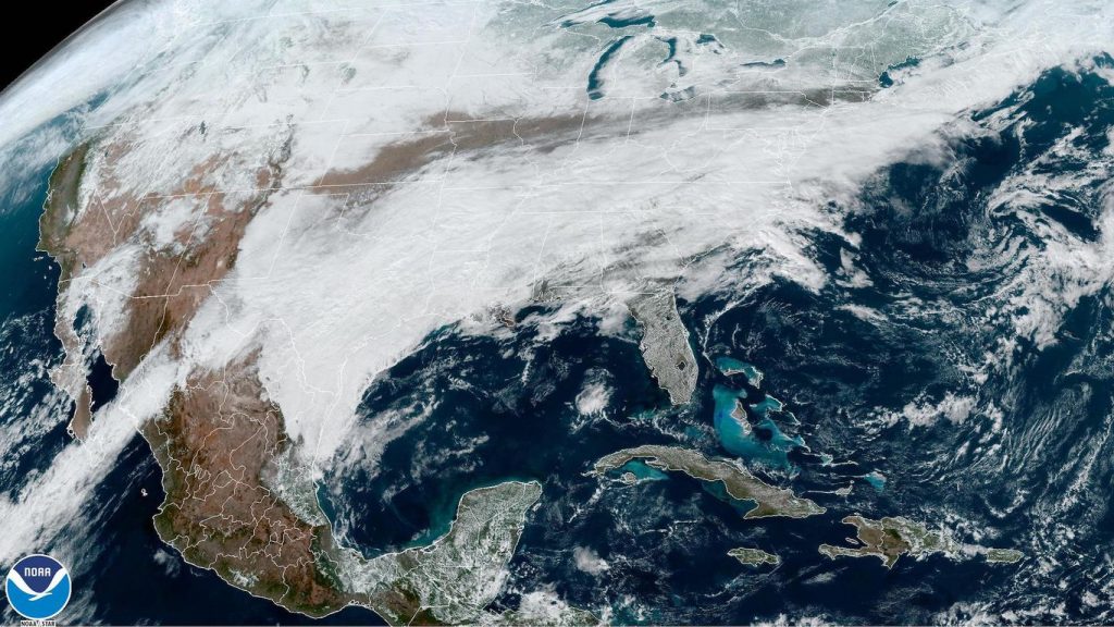
The combination of moisture from the Gulf of Mexico and Arctic air spilling south from Canada is resulting in a long-duration ice storm for millions of people across at least eight states.
The big picture: At least six people in Texas have died as sleet, snow and freezing rain snarled road and air travel. Waves of mixed precipitation are forecast to spread northeast with time, lasting through early Thursday.
- Ice storm warnings are in effect for 12 million people across large portions of Texas, including the Dallas-Ft. Worth metro area, western Tennessee, northern Mississippi and much of Arkansas.
- A swath of winter storm warnings and winter weather advisories are also in effect for parts of Texas, Oklahoma, Arkansas, New Mexico, West Virginia and Virginia.
Zoom in: The National Weather Service warned of “significant impacts” from the freezing rain and sleet, including an increasing threat of power outages.
- Numerous car accidents were reported along the Interstate 35 corridor between Dallas and Oklahoma City Tuesday, and Austin police reported dozens of accidents, including some involving their own personnel.
- One person was killed in Austin after being involved in a traffic pileup Tuesday. Another person, a 45-year-old man, died Monday night after his vehicle slid into a highway guardrail near Dallas amid icy road conditions, causing him to roll down an embankment, per AP.
- The NWS forecast office in Austin is warning of extremely dangerous road conditions on Wednesday morning as light freezing rain falls across the city.
Threat level: The wintry mix, which was falling heavily in some areas, is expected to worsen as a new round of precipitation gathers across Texas and pushes quickly northeastward. The NWS forecast office in Dallas urged people to avoid travel if possible until early Thursday.
- “Already hazardous roadways will continue to deteriorate across North and Central Texas with travel becoming near impossible today,” forecasters said in an online discussion.
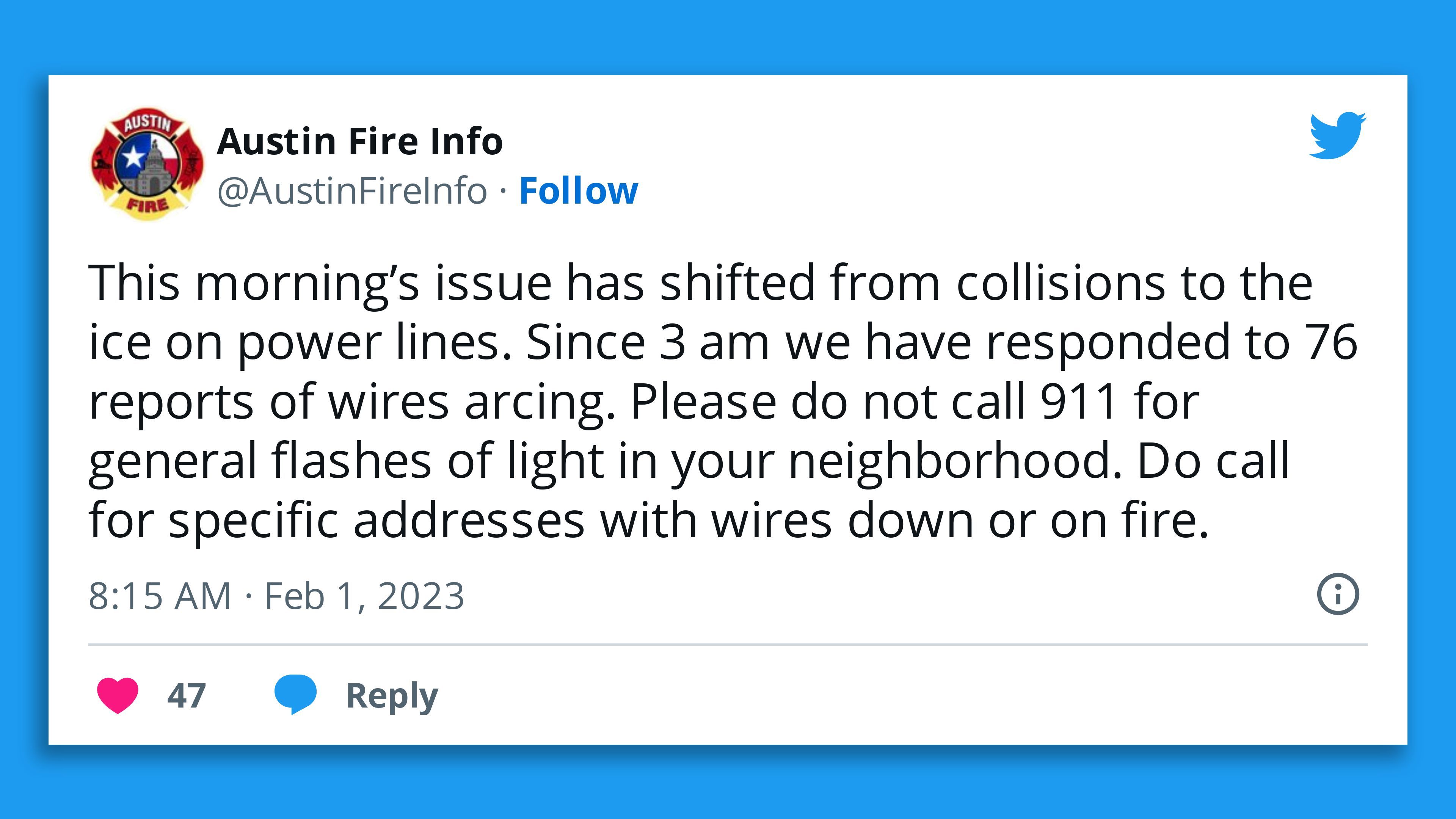
Of note: The areas at greatest risk for power outages are in Texas, and a stretch from Little Rock to Memphis.
- More than 364,000 customers were without power in Texas Wednesday evening, according to PowerOutage.us. Many of the outages are in the Austin area, with about 163,000 customers of Austin Energy in the dark.
- “Significant accumulations of ice and sleet are expected across much of the area, resulting in widespread impacts to travel and infrastructure,” the NWS forecast office in Memphis stated in a forecast discussion.
Flight delays
- In addition to the treacherous roadways, the winter storm was also causing air travel delays that are rippling out across the country.
- Through 8:30 p.m. ET, 2,389 flights within, into or out of the U.S. had been canceled Wednesday. The majority of flights are coming from or going to Dallas Ft. Worth International Airport, Dallas Love Field, and Austin, according to FlightAware data. At least 3,584 flights had been delayed.
- Memphis International Airport, the main hub for FedEx, as well as Austin and Nashville, have also been seeing numerous flight cancellations or delays related to the winter storm.
Arctic air sets records
What’s next: The cold air responsible for the icy mix has been setting records in the Rockies and Plains, and by this weekend, one of the coldest outbreaks in years, possibly decades, will roar into New England.
- Tuesday morning saw the temperature in Wyoming dip to the minus-30s, and Denver reached a record low of minus-10 on Monday.
- A piece of the polar vortex in the lower atmosphere will whip from Hudson Bay across New England Saturday, sending temperatures plunging amid strong northwesterly winds.
- Wind chills in Boston could reach minus-30°F, with minus-50°F wind chills a possibility in northern New England.
- Wind chill watches are in effect for 16 million people across New England, including Boston, Hartford and Portland, Maine.
- Fortunately, the Siberian-level cold will be brief, with temperatures moderating by Monday.
Editor’s note: This article has been updated with additional details throughout.